

My name is Christopher Gutteridge and I spend a worrying amount of time doing stuff in Minecraft.
Minecraft Ventnor is a year long project by me, a one-time Ventnor resident.
Images from the project will be on show as part of the Undecided Art Collective's new show "Undecided on Dreams", at Cafe 34 in Ventnor from the 11th to 16th of August, 2015.
you can even download a copy of the save-file so you can play around with it yourself (or blow it up with TNT). I've also written a nifty computer program which has created a much larger part of Ventnor and Bonchurch using open data I've found online. You can download that too.
Ventnor is a sea-side town on the South coast of the Isle of Wight, UK. It's very nice. You should go.
Minecraft is one of the most successful computer games of all time. It is popular with many ages, and there are lots of different ways to enjoy it, from simply exploring, building huge models with friends, or playing with the bewildering range of mods people have created. Think of it as LEGO with unexpected zombie attacks making it really important to build a safe place to hide in at night.
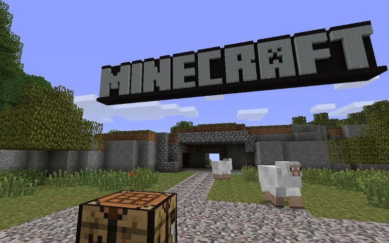
(This Minecraft title pic was built in Minecraft by hobbymp and placed on Flickr wih a CC-BY License)


We were going to make the downloads available next week, but they are going live now due to a shameful shortage of memory sticks to give out at Ventnor Minecraft Club. In our defence, we thought 25 would be enough and had over 50 people show up!
Images on this website may be used on this site under a CC-BY-NC license. Press may use the images for the purposes of describing the project, Ventnor Fringe or Undecided Art Collective. You may not use images I created for making money or advertising your business without my permission.
These downloads are Minecraft maps for use with the PC or OSX or Linux version of Minecraft. They won't work on Playstation, XBox or tablets, sorry.
Each of these downloads is a ZIP file which you will need to unzip. The resulting folder should be moved to your Minecraft "saves" directory. They you will have the option to play that would when you choose "single player". If you need more help see this guide to installing new Minecraft maps.
If you have any trouble, drop me an email, and when I next read my email I'll try to help.

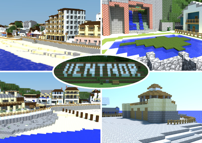
This is the model of Ventnor I made by hand in survival mode! CC-BY-NC.
(pro tip; there's an easter egg somewhere around the bandstand...)

Open Data Version of Ventnor. CC-BY-SA.
Fairy & Nether Version of Ventnor. CC-BY-SA.

Open Data Southampton. CC-BY-SA.

The software for producing minecraft worlds from LIDAR data and open streetmap is free to reuse (if you manage to figure it out).
So, this section goes into the details of how I put it all together. What it can't and doesn't do is explain why.
The whole model of Ventnor seafront was build (almost all by my) on our minecraft server Agnomen. This is a "survival" server hosted at the University of Southampton. Building this is survival mode means that I had to mine the stone & sand, chop down the trees, and remove a very large mountain where the Spyglass needed to go. It also means there were nighttime zombie attacks and occasional reparis required due to creeper damage. Why did I do it like this? Because I was having fun.


These boxes contain all the cobble my (mildish) OCD wouldn't allow me to throw away (the download version has empty chests due to a screw up moving data between Minecraft versions, but they are still full on our server)
I assume I'll be soon featured on Britains Biggest Minecraft Hoarders.
I cheated a tiny little bit by using "fly" mode to take a few screenshots like this while I was building the model.
Later, I exported just that bit of our server to a separate file so people could download it and I did a teeny tiny amount of fixes in creative mode (in the interests of full disclosure).
Here you can see the footprints of some of the buildings mapped out using carpet tiles.


I used a grid drawn over Open Streetmap to work out layouts, putting a yellow marker every 10 blocks/meters. Actually the model is 11 blocks = 10 meters just to give me a tad more wiggle room.
Most of the buildings could be bodged into lining up with the Minecraft blocks, but notable exceptions were the Spyglass and Wintergardens which were tricky. The Met and Gaiety have a gentle slope in their frontages lining up with the repeating elements of their structure, but the Spyglass was just a pain, and don't get me started on the roof. It's got something like 7 or 8 different sections.
Digging up sand, and sheep farming, were surprisingly time consuming parts to this project. The roads are all dark-grey carpet, which is made from dark-grey wool, which is harvested from sheeps. This takes time.
This picture shows the ugly underbelly of the model, and an exhausted sand quarry, plus farms to produce food to stop my starving while building everything. This made it more fun, honest.
What you can't see here, but could if you explore the model's nooks, is the secret rooms I built as stores and work rooms... try looking under the bandstand, the Gaiety and behind the Ale & Oyster...


Next I worked out how to copy just the relevant "regions" from our main server and copy them into an empty world. This was important as otherwise the download would be serveral gigabytes as we've explored about 20,000 blocks in every direction.
Then I used a tool called Chunky to raytrace scenes from the model. This makes everything look a bit more pretty than a normal screenshot as they have shadows and reflections. These took between 3 and 20 hours to render depending on the size, and "night" versions took much longer.
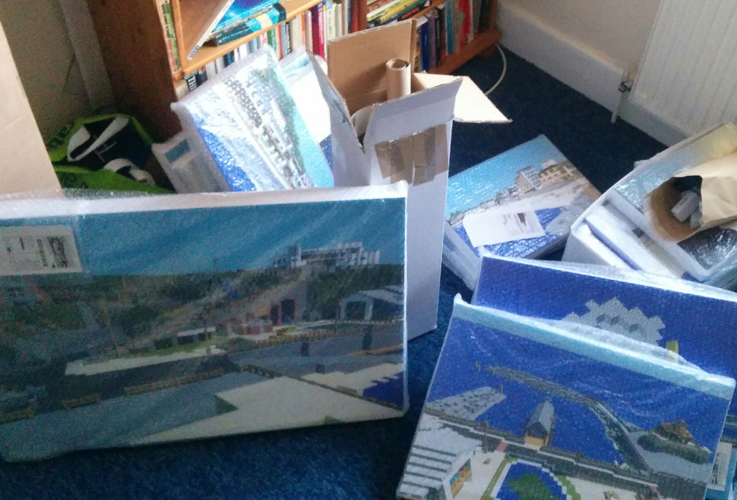
The last step was to have the best of the rendered images professional printed onto stretched canvas.
Actually, the last step was to get them to the Island, and with one canvas 210cm long that required the help of a friend with access to a large vehicle (thanks Josh!)
Once I had finished everything, I was surprisingly ahead of schedule and I thought to myself how nice it would have been to have a tool that projected open street map roads and building outlines into Minecraft...
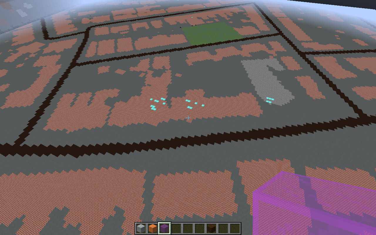
I happen to be a computer programmer and do quite a lot of work in the area of Open Data so decided to try to write it. The first version was useful but boring as you can see from the picture on the left. It works out for each block what the real world latitude and longitude would be then looks at open streetmap to see what colour that bit is and sets a block based on that... water, grass etc.
The screenshot is the area around Ventnor Library run through this process.
To make it more interesting I then ran it over Southampton, using LIDAR data from Hampshire Hub (Hampshire country-council open data service). This data gave a reading of how high the ground was on a 20m grid of all of Hampshire and was open data (thanks!). LIDAR is a distance-measuring laser that is waved around from a aeroplane, usually at the same time as doing aerial photography.
I also set buildings to be 10 blocks high. It looks a bit weird that the tops of the buildings follow the slopes, but generally it worked nicely. The data didn't quite line up and I had to apply a fiddle factor -- I suspect that I have an error in my geometric conversions somewhere. Ah well, works OK warts and all...
This picture is Highfield Campus at the University of Southampton


I went along with this to a map-maker's club in Southampton, run by someone from Ordnance Survey. There I met a lady who works for the Oceanography Center who told me about the wonderful open data they have buried in their site. This includes 1m scale LIDAR for the coast of much of the UK, including Ventnor. Unlike the HampshireHub data this doesn't remove buildings and trees, so no need to do my extrude trick. As you can see the results are slighly wobbley but pretty cool and make a great basis for making proper models of the town.
The screenshot is the area around Ventnor Library with the Channel Coast Observatory LIDAR data applied.
Where it came out really cool is along the cliffs and coast. It's a bit gutting to see the cascade and cliffs rendered automatically after spending night after night pouring over reference photos trying to build it by hand!

The final version is about 3000x2000 blocks and extends from The Undercliff to Bonchurch, the beach to Upper Ventnor.
An unexpected application is shown here, where you can see clearly an error in the Open Street Map data (which someone nice has now corrected as a result).
This entire huge version of Ventnor is free to download, modify and redistribute so long as you credit: Christopher Gutteridge, Open Street Map and the Channel Coast Observatory for our contributions.


My name's Christopher Gutteridge. I grew up (ish) in Ventnor but moved away in 1997. I've been coming to Ventnor Fringe Festival since it began, but this is the first year I've made an "artistic" contribution.
I spend most of the rest of my time working for the Web & Data Innovation & Development Team at the University of Southampton. The most interesting stuff I work on is open access to research papers, open data and research data management.
Mail: cjg@ecs.soton.ac.uk | Twits: @cgutteridge | Minecraft: cgutteridge
Thanks to...
Caitlain - for inspiring the idea.
Caroline Ault
Undecided Art Collective and Rachel Berry
Cafe 34, Ventnor
Ventnor Library Minecraft Club
Phil Basford
Jack Edge
Jesper Öqvist - author of Chunky which I used to do the nice ray-traced versions.
Ventnor Fringe Festival and Ventnor Exchange
Nick Gibbins and Alex Gark - vast stacks of RSI-reducing TNT
Seb Fry - the only person other than myself to contribute to the model itself
Josh Leighton
John Armstrong and Annette Lamballe
Hampshire Hub (Hampshire Council Open Data) and Mark Braggins
Orbit Print - for dealing with my more odd shaped printing